
Nine Track Realignments |
||||||||||
|
Abandoned NC&STL Railway South of Hollow Rock
South of Cooper Clay Spur
Between Wildersville and Timberlake
Wards
West of Life
Huron
Southwest of Neely
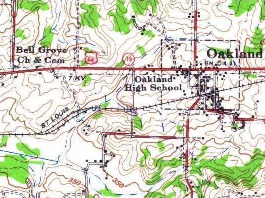
West of Oakland
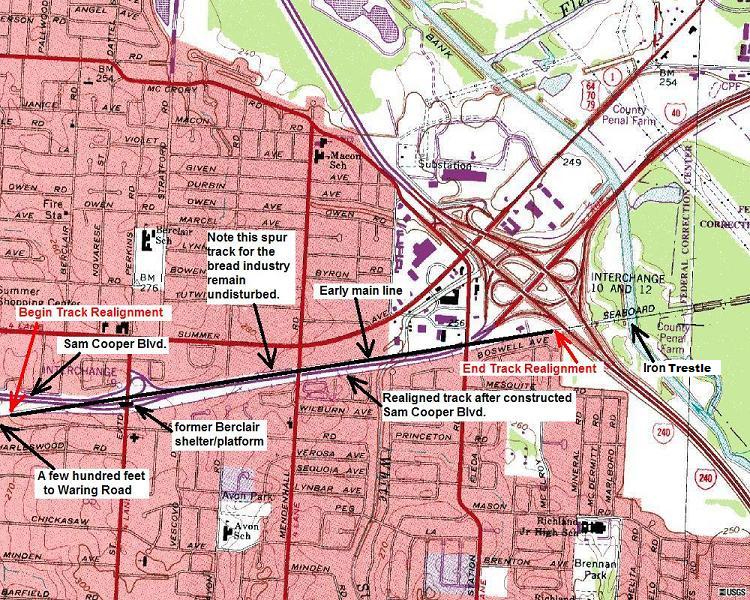
Between Berclair and I-240 Expressway
|
||||||||||
|
|
||||||||||
| Eric's
Homepage | Bridges
| Depot List
| Mystery Station
| Photos |
Railroad Museums This page maintained by Eric C. Fleet. |
||||||||||


NC&StL Preservation Society is in no way affiliated with the NC&StL
Railway or any of it's successors.
As a non-profit entity, NCPS presents these pages to the public purely
for educational and historic interest.
Return
to top |
Home | About
Us | History | Engine
576 | Cities | People
| Model
Railroading
Membership | Merchandise
| Links | Site
Map | Contact Us | Privacy
Policy
If you have information
you would like to contribute,
we would appreciate
hearing from you.
© 2003-2008, Nashville, Chattanooga & St. Louis Railway Preservation Society, inc.